 |
 |
 |
 |
 |
 |
 |
 |
 |
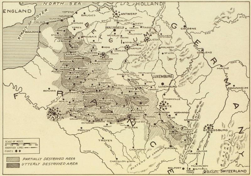
 Europe 1914,
from Life, 10/3/1938 |
 Europe 1920,
from Life, 10/3/1938 |
|
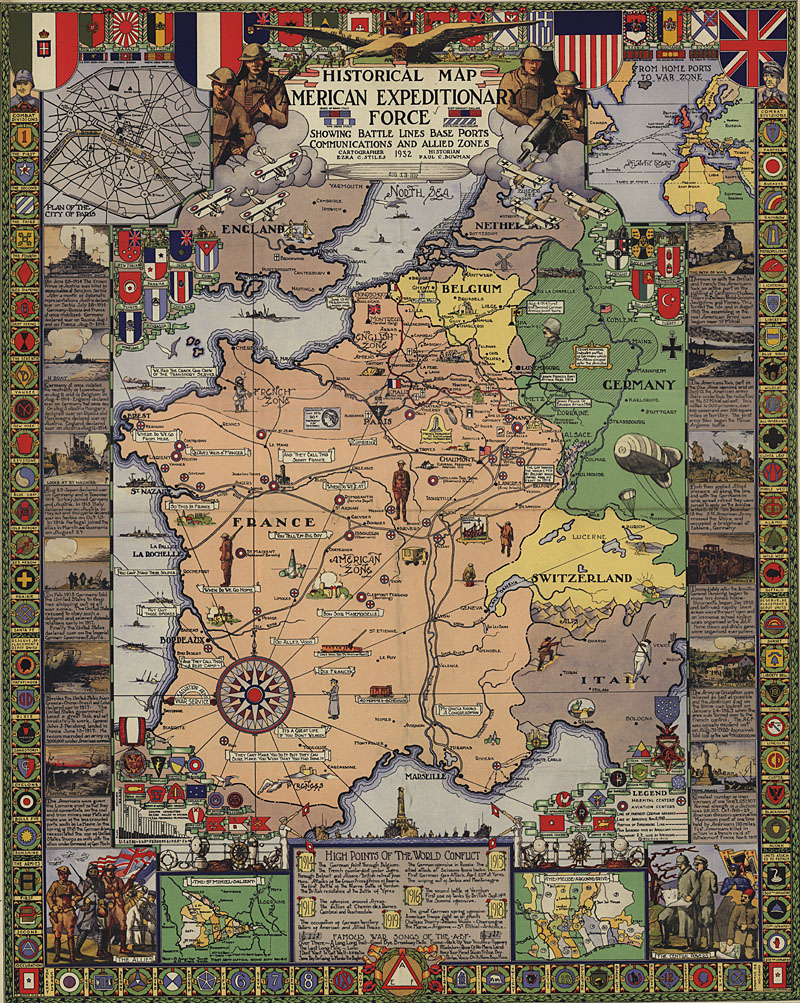
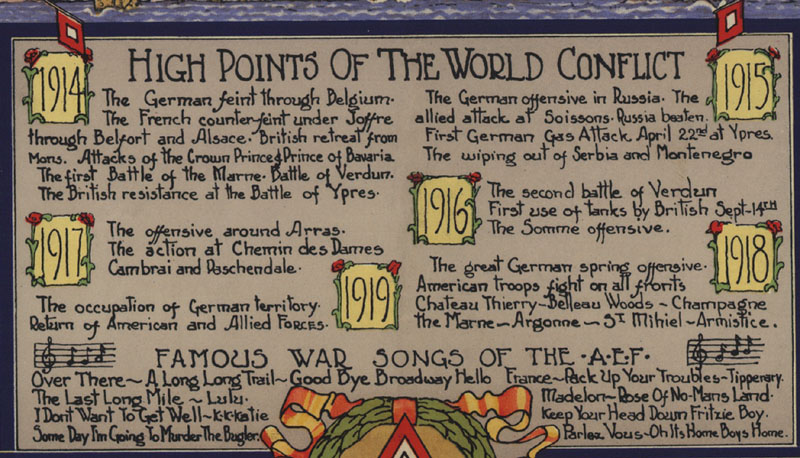
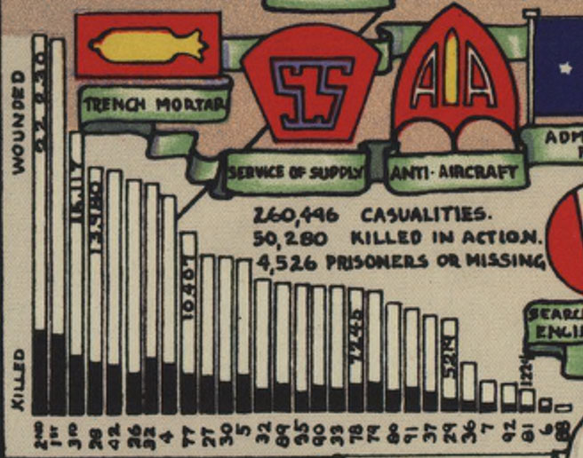
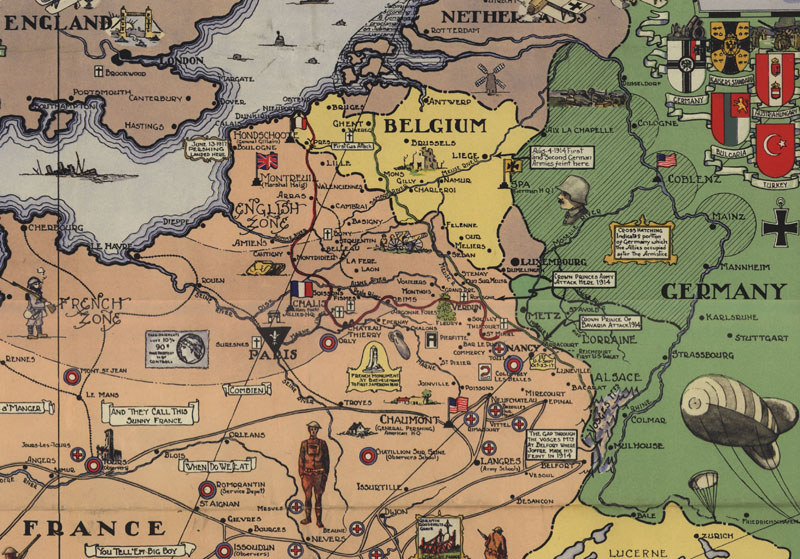
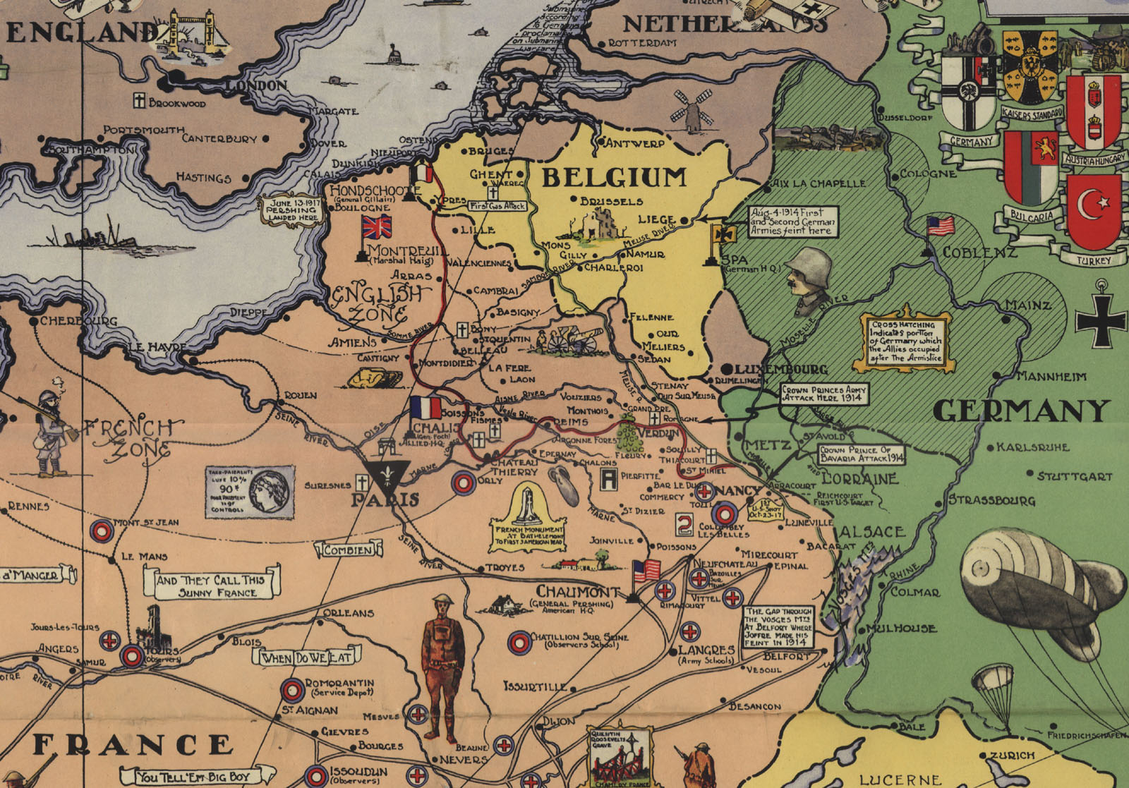
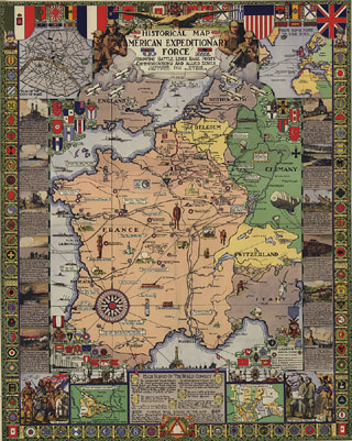
Historical map American Expeditionary Force 1918, by Ezra C. Stiles, cartographer, and Paul C. Bowman, historian, published 1932 by Herbick & Held Printing Co., Pittsburgh PA,. Includes insets: Plan of the city of Paris -- From home ports to war zone -- The Meuse-Argonne drive -- The St. Mihiel salient. Includes textual material : High points of the world conflict--The path of war. Map border consists of badges of the combat divisions, in color. SOURCE: Library of Congress Geography and Map Division Washington DC. DIGITAL ID: g5701s ct001052. URL: http://hdl.loc.gov/loc.gmd/g5701s.ct001052 |
|
|
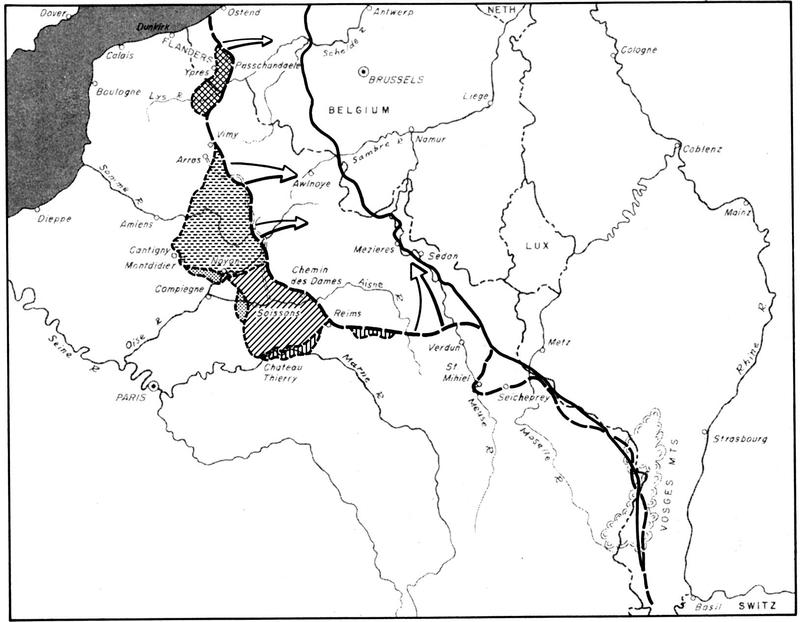
Map of the Western Front in Europe 1918, from "World War I: The U. S. Army Overseas" By Charles B. Macdonald in American Military History, Army Historical Series. SOURCE: U. S. Army Center of Military History. URL: http://www.army.mil/cmh-pg/books/AMH/AMH-18.htm |
|
|
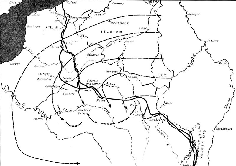
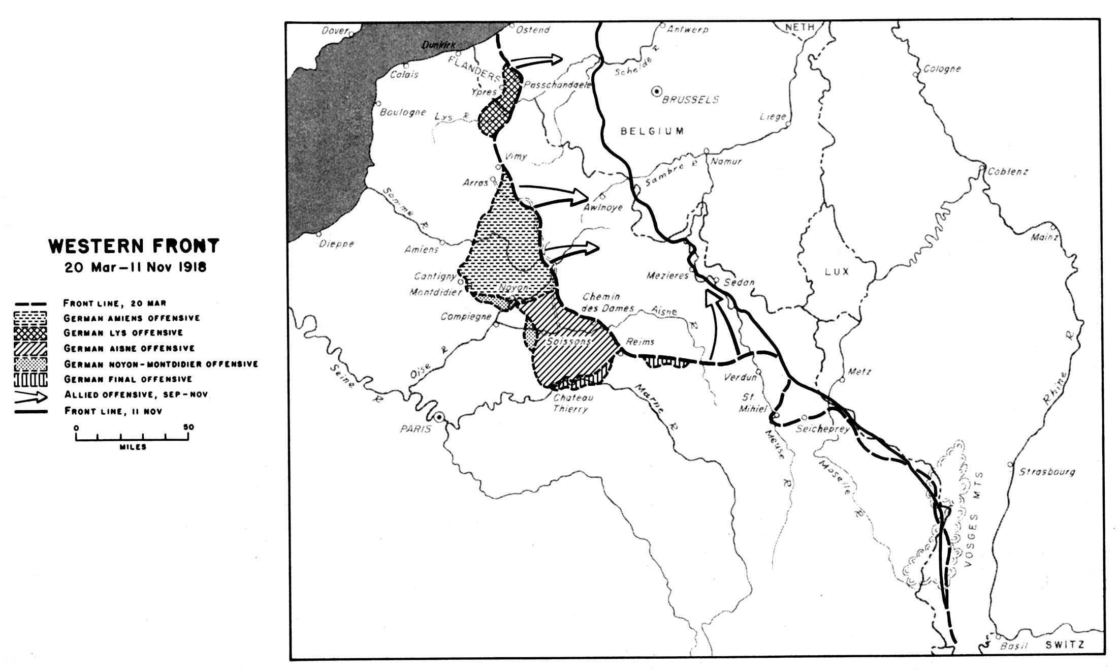
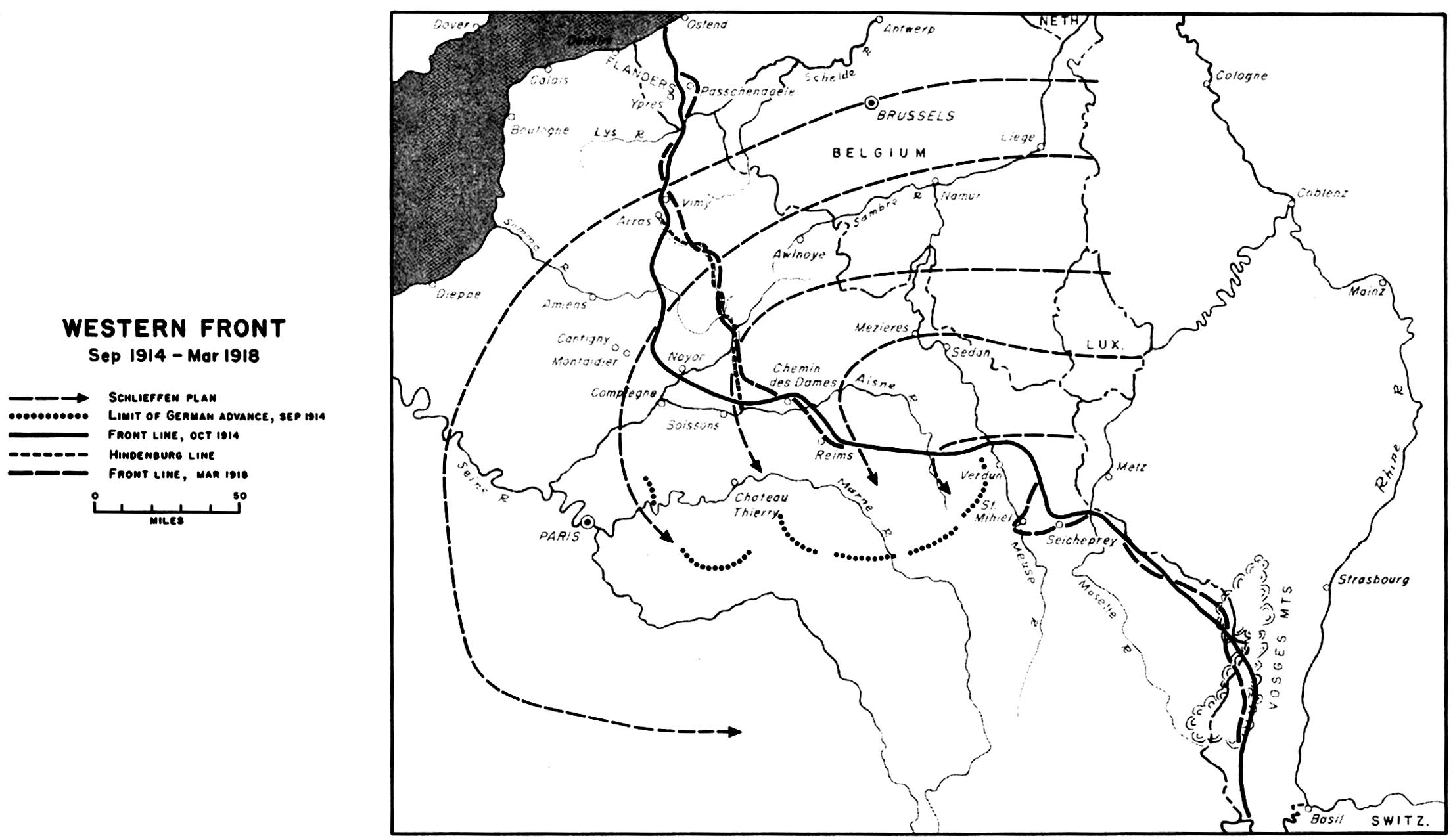
Map of the changing Western Front in Europe 1914-1918, from "World War I: The U. S. Army Overseas" By Charles B. Macdonald in American Military History, Army Historical Series. SOURCE: U. S. Army Center of Military History. URL: http://www.army.mil/cmh-pg/books/AMH/AMH-17.htm |
|