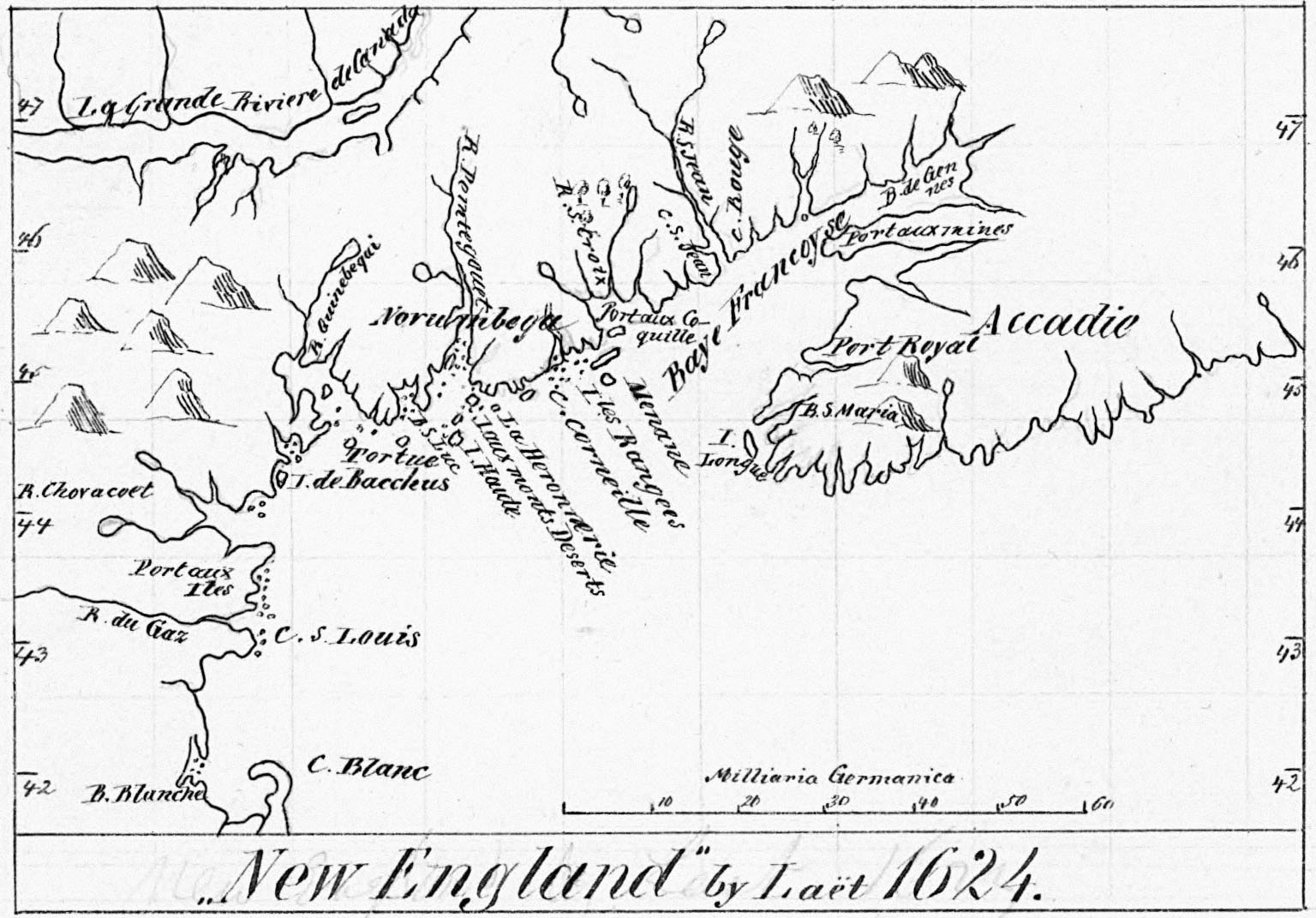
| New England 1624 by Joannes de Laet (1593-1649). DIGITAL ID: g3300 np000003 URL: http://hdl.loc.gov/loc.gmd/g3300.np000003 SOURCE: Library of Congress Geography and Map Division Washington, D.C. |
 1624 New England - bg
|
| New England 1624 by Joannes de Laet (1593-1649). DIGITAL ID: g3300 np000003 URL: http://hdl.loc.gov/loc.gmd/g3300.np000003 SOURCE: Library of Congress Geography and Map Division Washington, D.C. |
1624 New England - bg
|
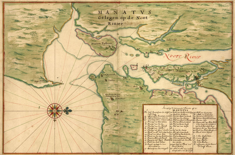
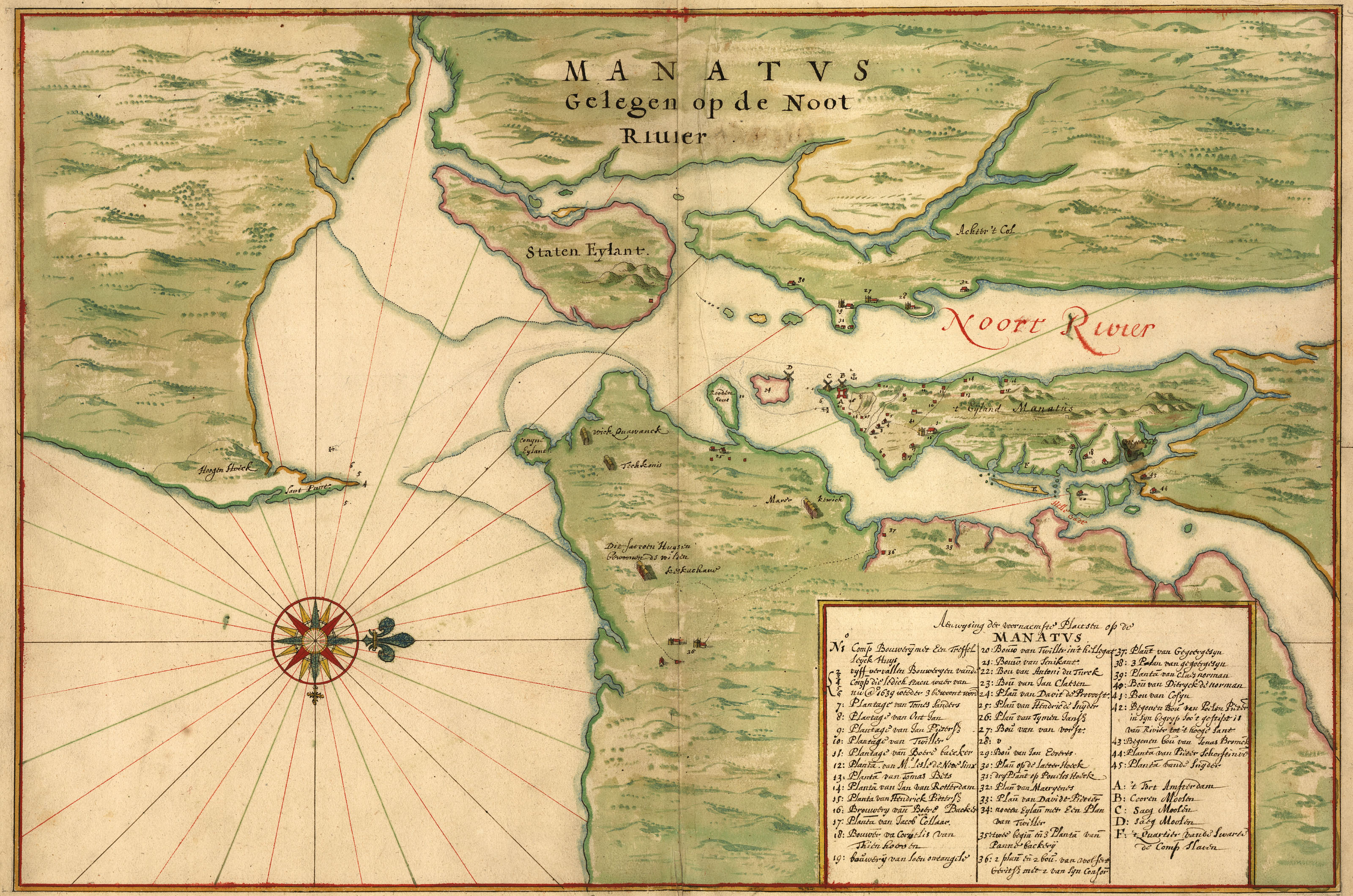
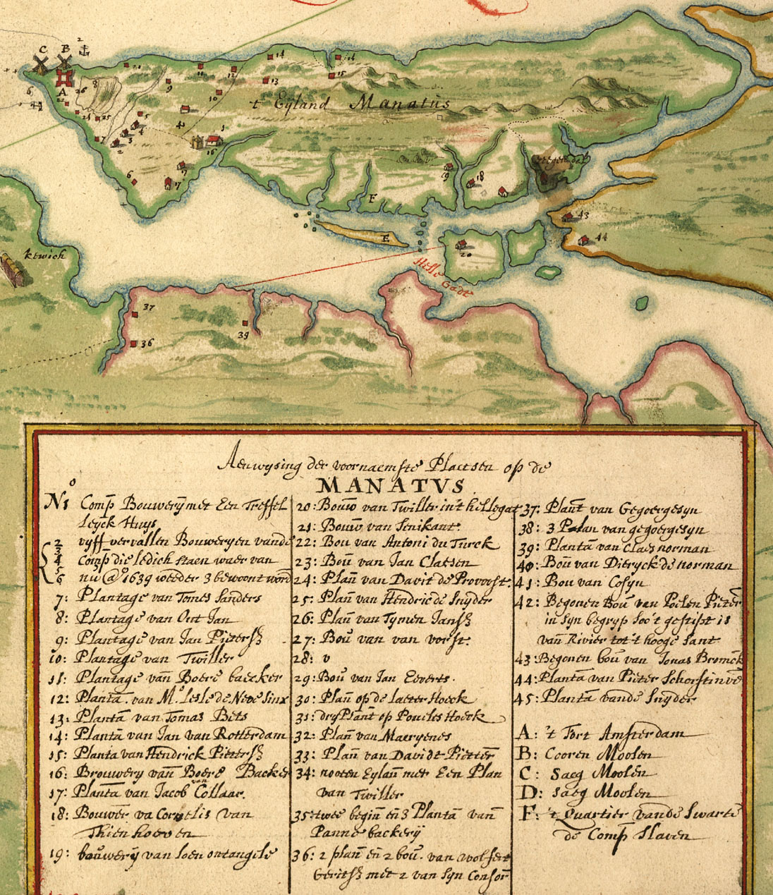
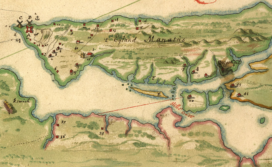
| New York and Manhattan region "Manatvs gelegen op de Noot [sic] Riuier" by Joan Vinckeboons, 1639. Pen-and-ink and watercolor. Pictorial map showing buildings and points of interest. Depths shown by soundings. Includes index of buildings with householders' names. DIGITAL ID: g3804n ct000050 URL: http://hdl.loc.gov/loc.gmd/g3804n.ct000050 SOURCE: Library of Congress Geography and Map Division Washington, D.C. |
 |
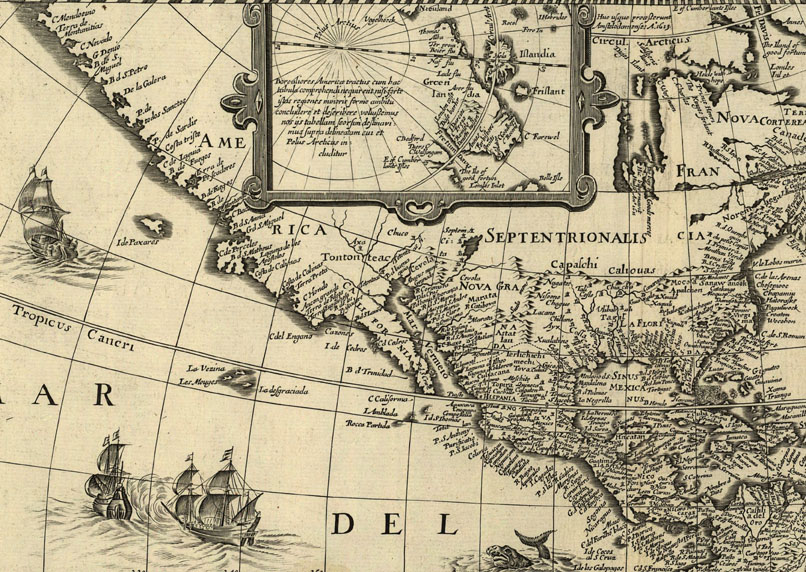
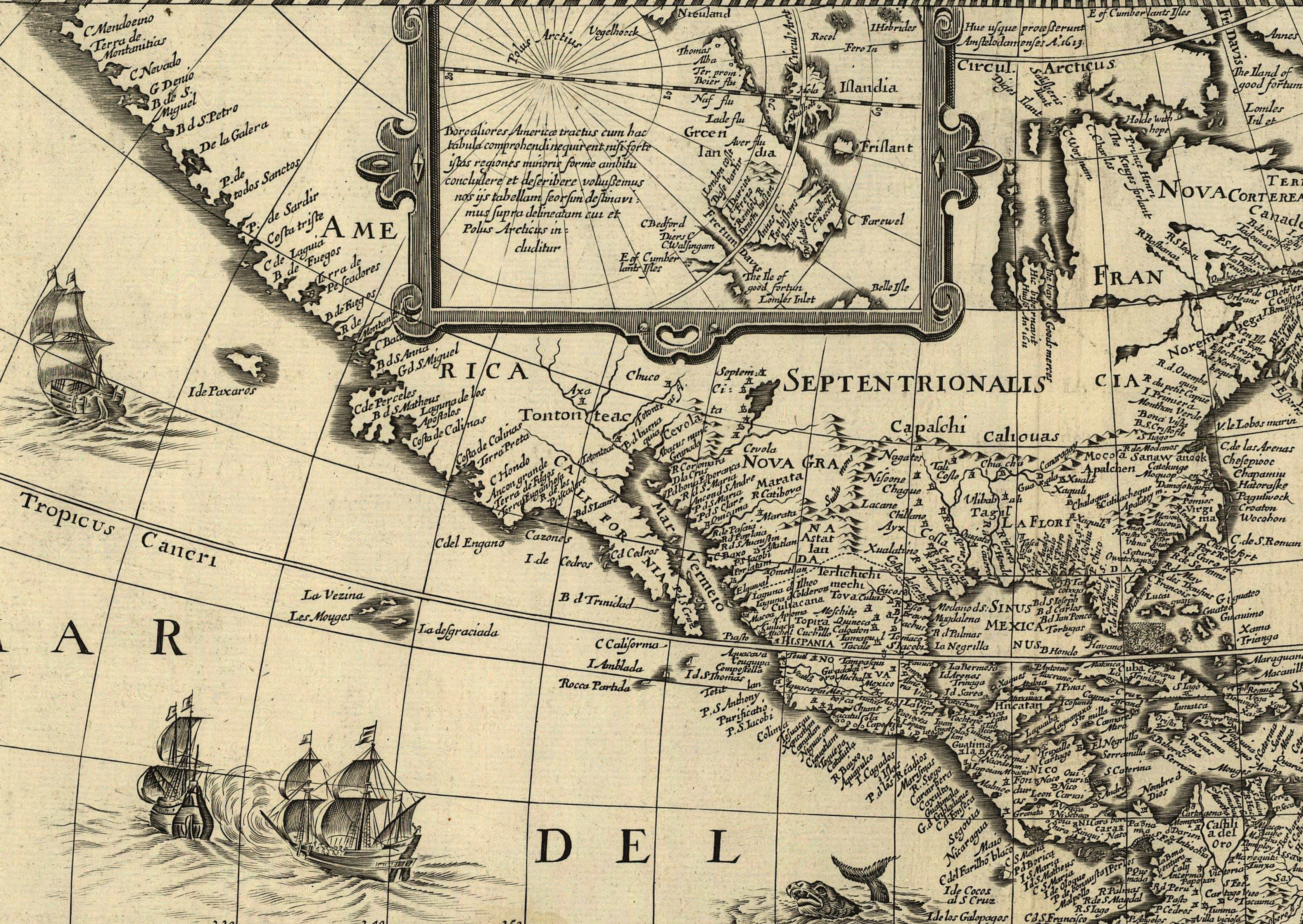
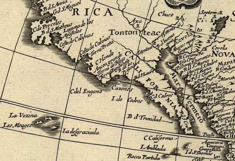
| America noviter delineata by Jodocus Hondius, Paris, 1640. Relief shown pictorially. Includes insets of north and south polar regions. DIGITAL ID: g3290 np000144 URL: http://hdl.loc.gov/loc.gmd/g3290.np000144 SOURCE: Library of Congress Geography and Map Division Washington, D.C. |
 |
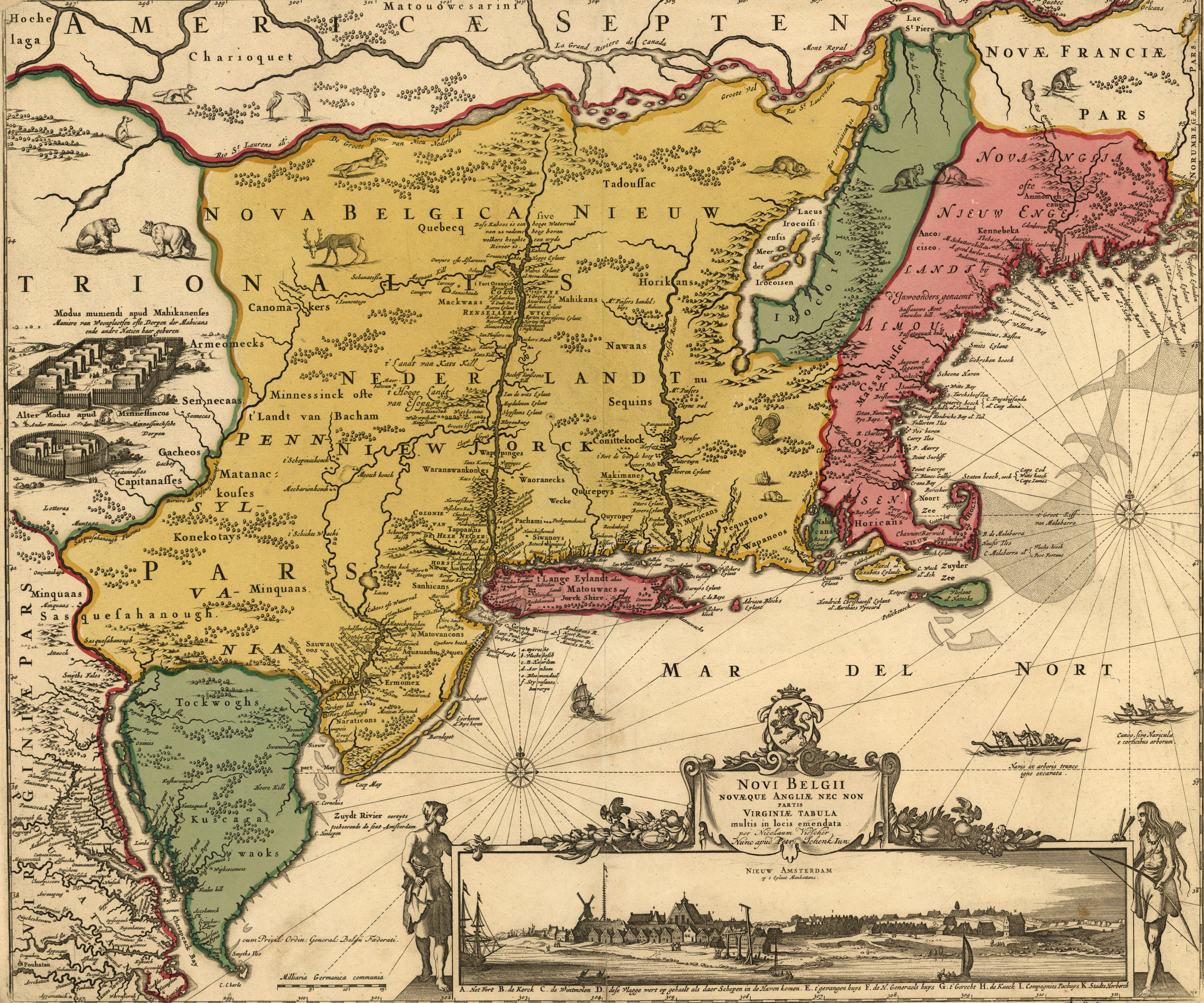
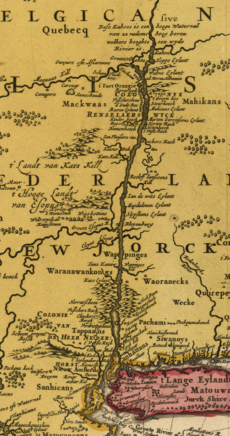
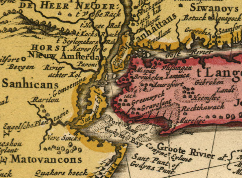
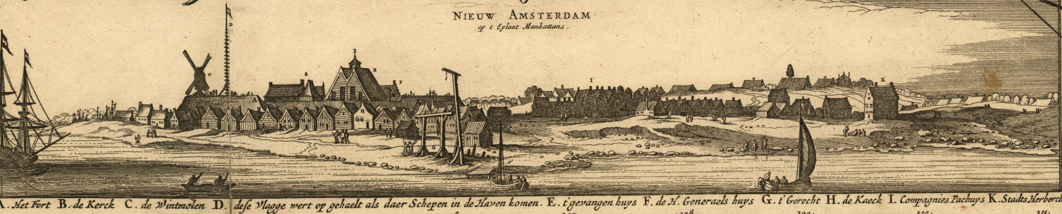
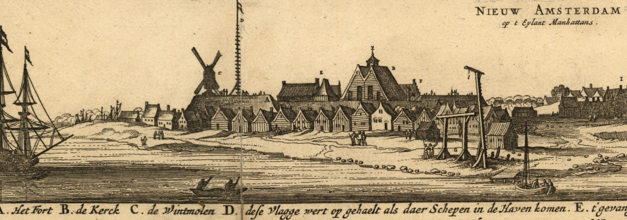
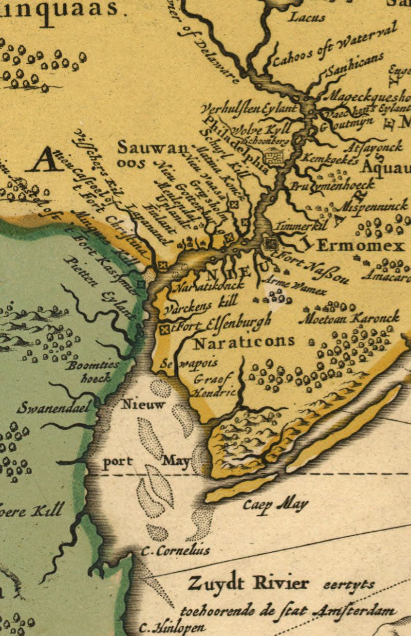
| "Novi Belgii Novćque Anglić : nec non partis Virginić tabula multis in locis emendata, Nieuw Amsterdam op t eylant Manhattans" by Nicolaum Visscher, Amsterdam, 1685. DIGITAL ID: g3715 ct000001 URL: http://hdl.loc.gov/loc.gmd/g3715.ct000001 SOURCE: Library of Congress Geography and Map Division Washington, D.C. |
 1685 New Amsterdam and bg - Hudson River - Manhattan - city sketch long - city sketch short - Del. Bay
|